Conceição do Mato Dentro
Conceição do Mato Dentro | |||
|---|---|---|---|
 Igreja Matriz de Conceição do Mato Dentro | |||
| |||
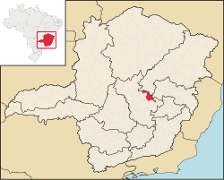
 Location in Minas Gerais | |||
 Conceição do Mato Dentro Location in Brazil | |||
| Coordinates: 19°02′13″S 43°25′30″W / 19.03694°S 43.42500°W / -19.03694; -43.42500Coordinates: 19°02′13″S 43°25′30″W / 19.03694°S 43.42500°W / -19.03694; -43.42500 | |||
| Country | |||
| Region | Southeast | ||
| State | |||
| Mesoregion | Metropolitana de Belo Horizonte | ||
| Microregion | Conceição do Mato Dentro | ||
| Incorporated (municipality) | March 11, 1942 | ||
| Government | |||
| • Mayor | José Fernando Aparecido de Oliveira | ||
| Area | |||
| • Total | 1,671.465 km2 (645.356 sq mi) | ||
| Elevation | 700 m (2,300 ft) | ||
| Population (2016) | |||
| • Total | 18,160 | ||
| [1] | |||
| Demonym(s) | conceicionense[2] | ||
| Time zone | UTC-3 (BRT) | ||
| • Summer (DST) | UTC-2 (BRST) | ||
CEP postal code | 35860-000 | ||
| Area code | 31 | ||
HDI (2010) | 0.672 | ||
| Website | cmd.mg.gov.br | ||
Conceição do Mato Dentro is a Brazilian municipality located in the state of Minas Gerais. The city belongs to the mesoregion Metropolitana de Belo Horizonte and to the microregion of Conceição do Mato Dentro.
Districts
Brejaúba, Conceição do Mato Dentro, Córregos, Costa Sena, Itacolomi, Ouro Fino do Mato Dentro, Santo Antônio do Cruzeiro, Santo Antônio do Norte, São Sebastião do Bonsucesso, Senhora do Socorro, Tabuleiro do Mato Dentro.
See also
- List of municipalities in Minas Gerais
- Site from Conceição do Mato Dentro
References
^ "Estimativas da população residente no Brasil e unidades da federação com data de referência em 1º de julho de 2016" (PDF). Brazilian Institute of Geography and Statistics (IBGE). 2016-07-01. Retrieved 2016-12-03..mw-parser-output cite.citation{font-style:inherit}.mw-parser-output q{quotes:"""""""'""'"}.mw-parser-output code.cs1-code{color:inherit;background:inherit;border:inherit;padding:inherit}.mw-parser-output .cs1-lock-free a{background:url("//upload.wikimedia.org/wikipedia/commons/thumb/6/65/Lock-green.svg/9px-Lock-green.svg.png")no-repeat;background-position:right .1em center}.mw-parser-output .cs1-lock-limited a,.mw-parser-output .cs1-lock-registration a{background:url("//upload.wikimedia.org/wikipedia/commons/thumb/d/d6/Lock-gray-alt-2.svg/9px-Lock-gray-alt-2.svg.png")no-repeat;background-position:right .1em center}.mw-parser-output .cs1-lock-subscription a{background:url("//upload.wikimedia.org/wikipedia/commons/thumb/a/aa/Lock-red-alt-2.svg/9px-Lock-red-alt-2.svg.png")no-repeat;background-position:right .1em center}.mw-parser-output .cs1-subscription,.mw-parser-output .cs1-registration{color:#555}.mw-parser-output .cs1-subscription span,.mw-parser-output .cs1-registration span{border-bottom:1px dotted;cursor:help}.mw-parser-output .cs1-hidden-error{display:none;font-size:100%}.mw-parser-output .cs1-visible-error{font-size:100%}.mw-parser-output .cs1-subscription,.mw-parser-output .cs1-registration,.mw-parser-output .cs1-format{font-size:95%}.mw-parser-output .cs1-kern-left,.mw-parser-output .cs1-kern-wl-left{padding-left:0.2em}.mw-parser-output .cs1-kern-right,.mw-parser-output .cs1-kern-wl-right{padding-right:0.2em}
^ "IBGE - Cidades@". O Brasil Município por Município. Brazilian Institute of Geography and Statistics (IBGE). Retrieved 2015-05-27.
This geographical article relating to Minas Gerais is a stub. You can help Wikipedia by expanding it. |


