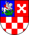
Bjelovar-Bilogora County
Bjelovar-Bilogora County Bjelovarsko-bilogorska županija | |
|---|---|
County | |
 Flag  Coat of arms | |
 Bjelovar-Bilogora County within Croatia | |
| Country | |
| County seat | Bjelovar |
| Government | |
| • Župan | Damir Bajs (Ind.) |
| • Assembly | 41 members
|
| Area [1] | |
| • Total | 2,640 km2 (1,020 sq mi) |
| Population (2011)[2] | |
| • Total | 119,764 |
| • Density | 45/km2 (120/sq mi) |
| Area code | 043 |
| ISO 3166 code | HR-07 |
HDI (2017) | 0.790[3] high · 17th |
| Website | www.bbz.hr |
Bjelovar-Bilogora County (pronounced [bjêloʋaːr-bîloɡora]; Croatian: Bjelovarsko-bilogorska županija [bjêloʋaːrsko-bîloɡorskaː ʒupǎnija]) is a county in central Croatia.
The central town of Bjelovar was first mentioned in 1413, and it only gained importance when a new fort was built in 1756 to defend against the Ottoman invasions. The town was pronounced a free royal town in 1874.
The other part of the county name is for the hill of Bilogora that stretches along the northern edge of the county.
Other towns in the county are Daruvar, Garešnica, Čazma and Grubišno Polje.
The Bjelovar-Bilogora County borders on the Koprivnica-Križevci County in the north, Virovitica-Podravina County in the northeast, Požega-Slavonia County in the southeast, Sisak-Moslavina County in the southwest and Zagreb County in the west.
Alongside the City of Zagreb and Požega-Slavonia County, it is the only Croatian county that does not border another nation.
Contents
1 Administrative division
2 Demographics
3 Protected areas
4 See also
5 References
6 External links
Administrative division
Bjelovar-Bilogora County is further divided into 5 towns and 18 municipalities.
| Town | Population (2011 census)[2] |
|---|---|
Bjelovar | 40,276 |
Čazma | 8,077 |
Daruvar | 11,633 |
Garešnica | 10,472 |
Grubišno Polje | 6,478 |
| Municipality | Population (2011 census)[2] |
|---|---|
Berek | 1,443 |
Dežanovac | 2,715 |
Đulovac | 3,245 |
Hercegovac | 2,383 |
Ivanska | 2,911 |
Kapela | 2,984 |
Končanica | 2,360 |
Nova Rača | 3,433 |
Rovišće | 4,822 |
Severin | 877 |
Sirač | 2,218 |
Šandrovac | 1,776 |
Štefanje | 2,030 |
Velika Pisanica | 1,781 |
Velika Trnovitica | 1,370 |
Veliki Grđevac | 2,849 |
Veliko Trojstvo | 2,741 |
Zrinski Topolovac | 890 |
Demographics
| Historical populations of Bjelovar-Bilogora County | |||||||||||||||||||||||||||||||||||||||||||||||||||||||
|---|---|---|---|---|---|---|---|---|---|---|---|---|---|---|---|---|---|---|---|---|---|---|---|---|---|---|---|---|---|---|---|---|---|---|---|---|---|---|---|---|---|---|---|---|---|---|---|---|---|---|---|---|---|---|---|
|
| ||||||||||||||||||||||||||||||||||||||||||||||||||||||
| Source: Naselja i stanovništvo Republike Hrvatske 1857–2001, Croatian Bureau of Statistics, Zagreb, 2005 | |||||||||||||||||||||||||||||||||||||||||||||||||||||||
As of the 2011 census, the county had 119,764 residents. The population density is 45 people per km2.
Ethnic Croats form the majority with 84.8% of the population, followed by Serbs at 6.3% and Czechs at 5.2%.[4]
Protected areas
- Papuk
See also
- Bjelovar-Križevci County
References
^ Ostroški, Ljiljana, ed. (December 2015). Statistički ljetopis Republike Hrvatske 2015 [Statistical Yearbook of the Republic of Croatia 2015] (PDF). Statistical Yearbook of the Republic of Croatia (in Croatian and English). 47. Zagreb: Croatian Bureau of Statistics. p. 62. ISSN 1333-3305. Retrieved 27 December 2015..mw-parser-output cite.citation{font-style:inherit}.mw-parser-output .citation q{quotes:"""""""'""'"}.mw-parser-output .citation .cs1-lock-free a{background:url("//upload.wikimedia.org/wikipedia/commons/thumb/6/65/Lock-green.svg/9px-Lock-green.svg.png")no-repeat;background-position:right .1em center}.mw-parser-output .citation .cs1-lock-limited a,.mw-parser-output .citation .cs1-lock-registration a{background:url("//upload.wikimedia.org/wikipedia/commons/thumb/d/d6/Lock-gray-alt-2.svg/9px-Lock-gray-alt-2.svg.png")no-repeat;background-position:right .1em center}.mw-parser-output .citation .cs1-lock-subscription a{background:url("//upload.wikimedia.org/wikipedia/commons/thumb/a/aa/Lock-red-alt-2.svg/9px-Lock-red-alt-2.svg.png")no-repeat;background-position:right .1em center}.mw-parser-output .cs1-subscription,.mw-parser-output .cs1-registration{color:#555}.mw-parser-output .cs1-subscription span,.mw-parser-output .cs1-registration span{border-bottom:1px dotted;cursor:help}.mw-parser-output .cs1-ws-icon a{background:url("//upload.wikimedia.org/wikipedia/commons/thumb/4/4c/Wikisource-logo.svg/12px-Wikisource-logo.svg.png")no-repeat;background-position:right .1em center}.mw-parser-output code.cs1-code{color:inherit;background:inherit;border:inherit;padding:inherit}.mw-parser-output .cs1-hidden-error{display:none;font-size:100%}.mw-parser-output .cs1-visible-error{font-size:100%}.mw-parser-output .cs1-maint{display:none;color:#33aa33;margin-left:0.3em}.mw-parser-output .cs1-subscription,.mw-parser-output .cs1-registration,.mw-parser-output .cs1-format{font-size:95%}.mw-parser-output .cs1-kern-left,.mw-parser-output .cs1-kern-wl-left{padding-left:0.2em}.mw-parser-output .cs1-kern-right,.mw-parser-output .cs1-kern-wl-right{padding-right:0.2em}
^ abc "Population by Age and Sex, by Settlements, 2011 Census: County of Bjelovar-Bilogora". Census of Population, Households and Dwellings 2011. Zagreb: Croatian Bureau of Statistics. December 2012.
^ "Sub-national HDI - Area Database - Global Data Lab". hdi.globaldatalab.org. Retrieved 2018-09-13.
^ "Population by Ethnicity, by Towns/Municipalities, 2011 Census: County of Bjelovar-Bilogora". Census of Population, Households and Dwellings 2011. Zagreb: Croatian Bureau of Statistics. December 2012.
External links
| Wikimedia Commons has media related to Bjelovar-Bilogora County. |
- Official website
Turistička zajednica Bjelovarsko-bilogorske županije Tourist Board
Coordinates: 45°54′10″N 16°50′51″E / 45.90278°N 16.84750°E / 45.90278; 16.84750

