List of protected areas of Illinois
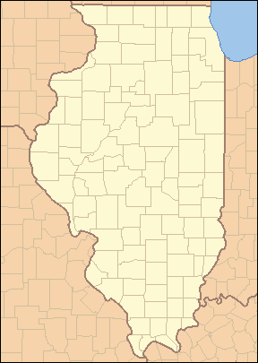 |
| Map of Protected Areas of Illinois Each dot is linked to the corresponding article: |
Illinois has a variety of protected areas, including 123 state protected areas - state parks, wildlife areas, recreation areas, nature reserves, and state forests. There are also federal and local level protected areas in the state. These levels interact to provide a variety of recreation opportunities and conservation schemes, sometimes in a small area. For instance, 1,500-acre (6.1 km2) Shabbona Lake State Park lies in DeKalb County which has its own 1,000-acre (4.0 km2) forest preserve system, while the city of DeKalb has a 700-acre (2.8 km2) park system. There is one UNESCO World Heritage Site in Illinois, Cahokia.
Contents
1 Overview
2 Federal protected areas
2.1 U.S. Wilderness Areas
2.2 National Forest Service
2.3 United States Fish and Wildlife Service
2.4 National Park Service
2.5 U.S. Army Corps of Engineers
3 Current state parks
3.1 Historic preservation
4 Local level parks
5 References
6 External links
Overview
Illinois has a wide variety of state owned and administered protected areas: state parks, state forests, state recreation areas, state fish and wildlife areas, state natural areas, and one state trail. They are all administered by the Illinois Department of Natural Resources. In addition, several of the state historic sites, administered by its Illinois Historic Preservation Division, also include nature reserves.
There is also one national forest, Shawnee National Forest, and several other sites administered by the National Park Service, including portions of National Trails. There are also National Wildlife Refuges.
Federal protected areas
U.S. Wilderness Areas
- Bald Knob Wilderness
- Bay Creek Wilderness
- Burden Falls Wilderness
- Clear Springs Wilderness
- Crab Orchard Wilderness
- Garden of the Gods Wilderness
- Lusk Creek Wilderness
- Panther Den Wilderness
National Forest Service
Midewin National Tallgrass Prairie - 15,454 acres (62.54 km2)
Shawnee National Forest - 500,000 acres (2,000 km2)
United States Fish and Wildlife Service
- Chautauqua National Wildlife Refuge
Crab Orchard National Wildlife Refuge - 43,500 acres (176 km2) including the 4,050-acre (16.4 km2) Crab Orchard Wilderness
- Cypress Creek National Wildlife Refuge
- Emiquon National Wildlife Refuge
- Hackmatack National Wildlife Refuge
- Mark Twain National Wildlife Refuge Complex
- Meredosia National Wildlife Refuge
- Middle Mississippi River National Wildlife Refuge
- Two Rivers National Wildlife Refuge
National Park Service
There are no national parks in Illinois but the Parks Service operates the federally owned 12-acre (49,000 m2) Lincoln Home National Historic Site in Springfield, Illinois and the Pullman National Monument in Chicago. The Chicago Portage National Historic Site is a NPS-affiliated site which is located in the Forest Preserve District of Cook County’s Portage Woods and Ottawa Trail Woods units. In addition, the NPS partners in the Abraham Lincoln National Heritage Area.
U.S. Army Corps of Engineers
Carlyle Lake - 26,000 acres (110 km2) of water and 11,000 acres (45 km2) of public land- Illinois Waterway
Lake Shelbyville - 11,100-acre (45 km2) lake and 23,000 acres (93 km2) of land
Rend Lake - 18,900 acres (76 km2) of water and 20,000 acres (81 km2) of land
Current state parks
State parks are owned by the state and generally administered by the Illinois Department of Natural Resources.[1]
Park Name | County or Counties | Area (acres) | Area (km2) | Year Established | Water Body(s) | Remarks |
|---|---|---|---|---|---|---|
| Adeline Jay Geo-Karis Illinois Beach State Park | Lake | 4,160 | 16.8 | 1948 | Lake Michigan | |
| Anderson Lake State Fish & Wildlife Area | Fulton | 2,247 | 9.09 | 1947 | Anderson Lake | |
| Apple River Canyon State Park | Jo Daviess | 297 | 1.20 | 1932 | Apple River | |
| Argyle Lake State Park | McDonough | 1,700 | 6.9 | 1948 | Argyle Lake | |
| Baldwin Lake State Fish & Wildlife Area | Randolph | 2,018 | 8.17 | ? | Baldwin Lake | |
| Banner Marsh State Fish and Wildlife Area | Fulton | 4,363 | 17.66 | ? | Illinois River | |
| Bartlett Woods Nature Preserve | Lee | 23 | 0.093 | 1987 | Big Bureau Creek | |
| Beall Woods State Park | Wabash | 635 | 2.57 | 1966 | Coffee Creek | |
| Beaver Dam State Park | Macoupin | 750 | 3.0 | 1947 | Beaver Dam Lake | |
| Big River State Forest | Henderson | 2,900 | 12 | 1925 | Mississippi River | |
Bohm Woods Nature Preserve[2] | Madison | 90 | 0.36 | ? | ||
| Buffalo Rock State Park & Effigy Tumuli | LaSalle | 298 | 1.21 | November 15, 1928 | Illinois River | |
| Cache River State Natural Area | Johnson | 14,314 | 57.93 | 1970 | Cache River | |
Cape Bend State Fish and Wildlife Area[3] | Alexander | 1,380 | 5.6 | ? | ||
| Carlyle Lake State Fish and Wildlife Area | Fayette | 37,000 | 150 | 1966 | Carlyle Lake | |
| Castle Rock State Park | Ogle | 2,000 | 8.1 | 1921 | Rock River | |
| Cave-in-Rock State Park | Hardin | 204 | 0.83 | 1929 | Ohio River | |
| Chain O'Lakes State Park | McHenry | 1,700 | 6.9 | 1945 | Bluff Lake, Catherine Lake, Channel Lake, Fox Lake, Fox River, Grass Lake, Marie Lake, Nippersink Lake, Petite Lake, Pistakee Lake, Redhead Lake, Turner Lake | |
| Channahon State Park | Will | 20.5 | 0.083 | 1932 | DuPage River, Des Plaines River, Kankakee River | |
| Clinton Lake State Recreation Area | DeWitt | 9,300 | 38 | 1978 | Clinton Lake, Salt Creek, Old Creek | |
| Coffeen Lake State Fish and Wildlife Area | Montgomery | 297 | 1.20 | 1966 | Coffeen Lake, Shoal Creek | |
| Crawford County State Fish and Wildlife Area | Crawford | 1,129 | 4.57 | ? | Huston Creek | |
| Delabar State Park | Henderson | 89 | 0.36 | 1960 | Mississippi River | |
| Des Plaines Fish and Wildlife Area | Will | 5,000 | 20 | 1948 | Kankakee River, Milliken Lake | |
| Dixon Springs State Park | Pope | 801 | 3.24 | 1946 | Wabash River | |
| Donnelley/Depue State Park | Putnam | 3,015 | 12.20 | 1982 | Lake DePue, Spring Lake, Coleman Lake, Illinois River | |
| Double T State Fish and Wildlife Area | Fulton | 1,961 | 7.94 | 2001 | Double T Lake | |
| Eagle Creek State Recreation Area | Shelby | 11,100 | 45 | May, 1963 | Lake Shelbyville, Eagle Creek | |
| Edward R. Madigan State Fish and Wildlife Area | Logan | 974 | 3.94 | 1971 | Salt Creek | |
| Eldon Hazlet State Recreation Area | Clinton | 3,000 | 12 | ? | Carlyle Lake, Lake Shelbyville | |
| Ferne Clyffe State Park | Johnson | 2,430 | 9.8 | 1949 | Ferne Clyffe Lake | |
| Fort Massac State Park | Massac | 1,450 | 5.9 | 1908 | Ohio River | |
| Fox Ridge State Park | Coles | 2,064 | 8.35 | 1930s | Ridge Lake, Embarras River | |
| Frank Holten State Recreation Area | St. Clair | 1,080 | 4.4 | 1964 | Whispering Willow Lake, Grand Marais Lake | |
| Franklin Creek State Park | Lee | 664 | 2.69 | 1970 | Franklin Creek | |
| Fults Hill Prairie State Natural Area | Monroe | 997 | 4.03 | 1970 | Kidd Lake | |
| Gebhard Woods State Park | Grundy | 30 | 0.12 | 1934 | Nettle Creek | |
| Giant City State Park | Jackson, Union | 1,100 | 4.5 | 1927 | Little Grassy Lake, Indian Creek | |
| Golconda Marina State Recreation Area | Pope | 274 | 1.11 | ? | Ohio River | |
| Goose Lake Prairie State Natural Area | Grundy | 2,537 | 10.27 | 1969 | Goose Lake, Des Plaines River, Kankakee River, Illinois River | |
| Green River State Wildlife Area | Lee | 2,565 | 10.38 | 1940 | Green River | |
| Hamilton County State Fish and Wildlife Area | Hamilton | 1,683 | 6.81 | 1962 | Dolan Lake | |
| Harry "Babe" Woodyard State Natural Area | Vermilion | 1,104 | 4.47 | ? | ? | |
| Hazel & Bill Rutherford Wildlife Prairie State Park | Peoria | 1,700 | 6.9 | 2000 | Deep Lake, Caboose Lake, Beaver Lake, Horseshoe Lake | |
| Heidecke Lake State Fish & Wildlife Area | Grundy | 1,300 | 5.3 | ? | Heidecke Lake | |
| Hennepin Canal Parkway State Park | Bureau, Lee, Whiteside, Rock Island, Henry | 60,314 | 244.08 | 1970 | Hennepin Canal | 104.5-mile (168.2 km) linear park (W To Moline then N to Rock Falls vic.) |
| Hidden Springs State Forest | Shelby | 1,200 | 4.9 | 1960 | Richland Creek, Possum Creek | |
| Horseshoe Lake State Fish & Wildlife Area | Alexander | 10,200 | 41 | ? | Horseshoe Lake | |
| Horseshoe Lake State Park | Madison | 2,960 | 12.0 | ? | Horseshoe Lake | |
| Illini State Park | LaSalle | 510 | 2.1 | 1934 | Illinois River | |
| Illinois Caverns State Natural Area | Monroe | 120 | 0.49 | 1985 | None | 9.6 km of the park are passages underground. |
| Iroquois County State Wildlife Area | Iroquois | 2,480 | 10.0 | 1944 | None | Occupies the edge of the former Glacial Lake Watseka. |
| James "Pate" Philip State Park | DuPage, Kane | 3,432 | 13.89 | 1991 | Brewester Creek | |
| Jim Edgar Panther Creek State Fish and Wildlife Area | Cass | 16,550 | 67.0 | June, 1993 | Gridley Lake, Prairie Lake, Drake Lake | |
| Johnson-Sauk Trail State Park | Henry | 1,365 | 5.52 | ? | Johnson-Sauk Trail Lake | |
| Jubilee College State Park | Peoria | 3,200 | 13 | 1933 | None | |
| Kankakee River State Park | Kankakee, Will | 4,000 | 16 | 1938 | Kankakee River | |
| Kaskaskia River State Fish & Wildlife Area | St. Clair, Monroe, Randolph | 20,000 | 81 | ? | Kaskaskia River, Baldwin Lake, Peabody River | |
| Kickapoo State Recreation Area | Vermilion | 2,842 | 11.50 | 1939 | Middle Fork | |
| Kinkaid Lake State Fish and Wildlife Area | Jackson | 11,750 | 47.6 | 1968 | Kinkaid Lake, Johnson Creek, Reed Creek | |
| Kishwaukee River State Fish and Wildlife Area | DeKalb | 570 | 2.3 | 2002 | Kishwaukee River | |
| Lake Le-Aqua-Na State Park | Stephenson | 715 | 2.89 | 1948 | Lake Le-Aqua-Na | |
| Lake Murphysboro State Park | Jackson | 1,022 | 4.14 | 1948 | Lake Murphysboro | |
| LaSalle Lake State Fish & Wildlife Area | LaSalle | 2,058 | 8.33 | ? | LaSalle Lake | |
| Lewis and Clark State Historic Site | Madison | 2002 | None | |||
| Lincoln Trail Homestead State Memorial | Macon | 162 | 0.66 | 1957 | Sangamon River | |
| Lincoln Trail State Park | Clark | 1,023 | 4.14 | 1958 | Lincoln Trail Lake | |
| Lowden State Park | Ogle | 207 | 0.84 | 1945 | Rock River | |
| Mackinaw River State Fish and Wildlife Area | Tazewell | 1,448 | 5.86 | 1970 | Mackinaw River | |
| Marshall State Fish & Wildlife Area | Marshall | 6,000 | 24 | 1925 | Illinois River | |
| Matthiessen State Park | LaSalle | 1,700 | 6.9 | 1943 | Deer Park Lake, Vermilion River | |
| Mautino State Fish and Wildlife Area | Bureau | 911 | 3.69 | ? | 15 lakes | |
| Mazonia/Braidwood State Fish and Wildlife Area | Grundy | 1,017 | 4.12 | 1981 | Braidwood Lake | |
| Mermet Lake State Fish and Wildlife Area | Massac | 2,630 | 10.6 | 1949 | Mermet Lake | |
| Middle Fork State Fish and Wildlife Area | Vermilion | 2,700 | 11 | 1986 | Middle Fork | |
| Mississippi Palisades State Park | Carroll | 2,500 | 10 | 1973 | Mississippi River, Apple River | |
| Mississippi River State Fish and Wildlife Area | Jersey, Calhoun | 24,386 | 98.69 | ? | Stump Lake, Fuller Lake | |
| Moraine Hills State Park | McHenry | 2,200 | 8.9 | 1939 | Lake Defiance, Fox River | |
| Moraine View State Recreation Area | McLean | 1,687 | 6.83 | 1959 | Dawson Lake, Salt Creek | |
| Morrison-Rockwood State Park | Whiteside | 1,164 | 4.71 | 1971 | Rock Creek, Lake Carlton | |
| Nauvoo State Park | Hancock | 148 | 0.60 | ? | Mississippi River, Lake Horton | |
| Newton Lake State Fish and Wildlife Area | Jasper | 1,775 | 7.18 | 1979 | Newton Lake, Sand Creek, Laws Creek | |
| North Point Marina | Lake | 297 | 1.20 | ? | Lake Michigan | |
| Peabody River State Fish and Wildlife Area | Randolph | 2,200 | 8.9 | ? | Peabody River | |
| Pere Marquette State Park | Jersey | 8,050 | 32.6 | 1931 | Mississippi River, Illinois River | |
| Piney Creek Ravine State Natural Area | Jackson, Randolph | 198 | 0.80 | 1972 | Piney Creek | |
| Prophetstown State Recreation Area | Whiteside | 53 | 0.21 | 1947 | Coon Creek, Rock River | |
| Pyramid State Recreation Area | Perry | 19,701 | 79.73 | 1968 | ? | |
| Ramsey Lake State Recreation Area | Fayette | 1,980 | 8.0 | ? | Ramsey Lake, Ramsey Creek | |
| Randolph County State Recreation Area | Randolph | 1,101 | 4.46 | 1958 | Randolph County Lake | |
| Ray Norbut State Fish and Wildlife Area | Pike | 1,140 | 4.6 | 1970 | Illinois River | |
| Red Hills State Park | Lawrence | 967 | 3.91 | 1953 | Muddy Creek | |
| Rend Lake State Fish and Wildlife Area | Franklin, Jefferson | 38,900 | 157 | ? | Rend Lake | |
| Rice Lake State Fish and Wildlife Area | Fulton | 5,660 | 22.9 | 1945 | Rice Lake | |
| Rock Cut State Park | Winnebago | 3,092 | 12.51 | 1957 | Pierce Lake, Olson Lake | |
| Rock Island Trail State Park | Stark, Peoria | 1989 | None | 26-mile (42 km) public rail trail. | ||
| Saline County State Fish and Wildlife Area | Saline | 1,270 | 5.1 | 1959 | Glen O. Jones Lake | |
| Sam Dale Lake State Fish and Wildlife Area | Wayne | 1,302 | 5.27 | 1959 | Sam Dale Lake | |
| Sam Parr State Fish and Wildlife Area | Jasper | 1,180 | 4.8 | 1960 | ||
| Sand Ridge State Forest | Mason | 7,200 | 29 | 1939 | None | |
| Sanganois State Fish and Wildlife Area | Cass, Schuyler, Mason | 10,360 | 41.9 | 1948 | ||
| Sangchris Lake State Recreation Area | Christian, Sangamon | 3,022 | 12.23 | 1964 | Sangchris Lake | |
| Shabbona Lake State Park | DeKalb | 1,550 | 6.3 | 1978 | Shabbona Lake | |
| Shelbyville State Fish and Wildlife Area | Moultrie | 6,200 | 25 | ? | Kaskaskia River, West Okaw River | |
| Sielbeck Forest Natural Area | Johnson | 385 | 1.56 | 1998 | ||
| Siloam Springs State Park | Adams, Brown | 3,323 | 13.45 | 1940 | ||
| Silver Springs State Fish & Wildlife Area | Kendall | 1,350 | 5.5 | 1969 | Fox River, Loon Lake, Beaver Lake, Silver Springs | |
| Snakeden Hollow State Fish and Wildlife Area | Knox | 2,500 | 10 | 1987 | Snakeden Hollow Lake | |
| South Shore State Park | Clinton | 26,000 | 110 | ? | Carlyle Lake | |
| Spitler Woods State Natural Area | Macon | 202.5 | 0.819 | 1937 | Squirrel Creek | |
| Spring Lake Fish and Wildlife Area | Tazewell | 2,032 | 8.22 | 1950 | Spring Lake | |
| Starved Rock State Park | LaSalle | 2,630 | 10.6 | 1911 | Illinois River | |
| Stephen A. Forbes State Recreation Area | Marion | 3,103 | 12.56 | 1959 | ||
| Ten Mile Creek State Fish & Wildlife Area | Hamilton, Jefferson | 6,000 | 24 | 1988 | Ten Mile Creek | |
| Trail of Tears State Forest | Union | 5,114 | 20.70 | 1929 | Mississippi River, Clear Creek | |
| Tunnel Hill State Trail | Johnson, Pulaski, Saline, Williamson | None | 45-mile (72.4 km) Trail. | |||
| Turkey Bluffs State Fish and Wildlife Area | Randolph | 2,264 | 9.16 | ? | ||
| Union County State Fish and Wildlife Area | Union | 6,202 | 25.10 | 1940s | ||
| Volo Bog State Natural Area | Lake | 1,150 | 4.7 | 1970 | Volo Bog | |
| Walnut Point State Park | Douglas | 671 | 2.72 | 1968 | ||
| Washington County State Recreation Area | Washington | 900 | 3.6 | 1959 | ||
| Wayne Fitzgerrell State Recreation Area | Franklin, Jefferson | 3,300 | 13 | 1975 | Rend Lake, Big Muddy River | |
| Weinberg-King State Park | Schuyler | 772 | 3.12 | 1968 | ? | |
| Weldon Springs State Recreation Area | DeWitt | 550 | 2.2 | 1948 | Salt Creek | |
| White Pines Forest State Park | Ogle | 385 | 1.56 | 1927 | Pine Creek, Spring Creek | Southernmost stand of virgin, native white pine trees in the state of Illinois.[4] |
| William G. Stratton State Park | Grundy | |||||
| William W. Powers State Recreation Area | Cook | 580 | 2.3 | 1947 | Wolf Lake | |
| Wolf Creek State Park | Shelby | 23,500 | 95 | 1968 | Lake Shelbyville, Wolf Creek | |
| Woodford State Fish and Wildlife Area | Woodford | 2,900 | 12 | Illinois River, Upper Peoria Lake |
Historic preservation
Around 50 usually smaller sites concerning historic structures are owned by the state and administered by the Illinois Historic Preservation Division, some of which may have a nature preservation component, including the Cahokia World Heritage Site and Lincoln's New Salem.[5]
Local level parks
A variety of county and town protected areas exist in Illinois, including city park districts and county-wide Forest Preserve Districts. One of the largest systems is the Forest Preserve District of Cook County, which includes Brookfield Zoo and the Chicago Botanic Garden as well as 69,000 acres (280 km2) of open land, or 11 percent of Cook County’s land area.
- Boone County Conservation District
- Byron Forest Preserve District - 900 acres (3.6 km2)
- Champaign County Forest Preserve District - 3,800 acres (15 km2)
Forest Preserve District of Cook County - 69,000 acres (280 km2)- DeKalb County Forest Preserve - 1,020 acres (4.1 km2)
Forest Preserve District of DuPage County - 24,000 acres (97 km2)- Forest Preserve District of Kane County - 17,135 acres (69.34 km2)
- Forest Preserves of the Kankakee River Valley - 250 acres (1.0 km2)
- Kendall County Forest Preserve District - 2,150 acres (8.7 km2)
- Lake County Forest Preserve - 26,200 acres (106 km2)
- Macon County Conservation District - 3,200 acres (13 km2)
- McHenry County Conservation District - 20,000 acres (81 km2)
- Putnam Country Conservation District - 950-acre (3.8 km2)
- Rock Island Forest Preserve District - 1,900 acres (7.7 km2)
- Vermilion County Conservation District - 6,000 acres (24 km2)
Forest Preserve District of Will County - 21,916 acres (88.69 km2)- Winnebago County Forest Preserve District - 9,000 acres (36 km2)
References
^ "State Parks & Outdoor Recreation". Illinois Department of Natural Resources. Retrieved 3 December 2018..mw-parser-output cite.citation{font-style:inherit}.mw-parser-output q{quotes:"""""""'""'"}.mw-parser-output code.cs1-code{color:inherit;background:inherit;border:inherit;padding:inherit}.mw-parser-output .cs1-lock-free a{background:url("//upload.wikimedia.org/wikipedia/commons/thumb/6/65/Lock-green.svg/9px-Lock-green.svg.png")no-repeat;background-position:right .1em center}.mw-parser-output .cs1-lock-limited a,.mw-parser-output .cs1-lock-registration a{background:url("//upload.wikimedia.org/wikipedia/commons/thumb/d/d6/Lock-gray-alt-2.svg/9px-Lock-gray-alt-2.svg.png")no-repeat;background-position:right .1em center}.mw-parser-output .cs1-lock-subscription a{background:url("//upload.wikimedia.org/wikipedia/commons/thumb/a/aa/Lock-red-alt-2.svg/9px-Lock-red-alt-2.svg.png")no-repeat;background-position:right .1em center}.mw-parser-output .cs1-subscription,.mw-parser-output .cs1-registration{color:#555}.mw-parser-output .cs1-subscription span,.mw-parser-output .cs1-registration span{border-bottom:1px dotted;cursor:help}.mw-parser-output .cs1-hidden-error{display:none;font-size:100%}.mw-parser-output .cs1-visible-error{font-size:100%}.mw-parser-output .cs1-subscription,.mw-parser-output .cs1-registration,.mw-parser-output .cs1-format{font-size:95%}.mw-parser-output .cs1-kern-left,.mw-parser-output .cs1-kern-wl-left{padding-left:0.2em}.mw-parser-output .cs1-kern-right,.mw-parser-output .cs1-kern-wl-right{padding-right:0.2em}
^ "Bohm Woods Nature Preserve". Illinois Department of Natural Resources. Retrieved 3 December 2018.
^ "Cape Bend State Fish and Wildlife Area". Illinois Department of Natural Resources. Retrieved 3 December 2018.
^ "Conserving the Land: The Rock River Country Archived 2005-04-19 at the Wayback Machine.," Critical Trends Assessment Program, Rock River Country Project ("Archived copy". Archived from the original on 2005-04-19. Retrieved 2007-07-03.CS1 maint: Archived copy as title (link) ), Illinois Department of Natural Resources, 3 July 2007.
^ "Visit a State Historic Site". Illinois Historic Preservation Division. Retrieved 3 December 2018.
External links
- Illinois Department of Natural Resources
- Recreation.gov
Protected areas of Illinois | |||||||||||||||||
|---|---|---|---|---|---|---|---|---|---|---|---|---|---|---|---|---|---|
| Federal |
| ||||||||||||||||
| State |
| ||||||||||||||||
| Local |
| ||||||||||||||||
| |||||||||||||||||
Springfield (capital) | ||
| Topics |
|  Seal of Illinois |
| Regions |
| |
| Municipalities |
| |
| Counties |
| |


