Amami Ōshima
Native name: 奄美大島, Amami Ōshima Nickname: Uushima | |
|---|---|
 Naze Port on Amami Ōshima | |
 | |
| Geography | |
| Location | East China Sea |
| Coordinates | 28°19′35″N 129°22′29″E / 28.32639°N 129.37472°E / 28.32639; 129.37472Coordinates: 28°19′35″N 129°22′29″E / 28.32639°N 129.37472°E / 28.32639; 129.37472 |
| Archipelago | Amami Islands |
| Area | 712.35 km2 (275.04 sq mi) |
| Coastline | 461.1 km (286.51 mi) |
| Highest elevation | 694 m (2,277 ft) |
| Highest point | Yuwandake |
| Administration | |
Japan | |
| Prefectures | Kagoshima Prefecture |
| District | Ōshima District |
| Largest settlement | Amami (pop. 44,561) |
| Demographics | |
| Population | 73,000 (2013) |
| Ethnic groups | Japanese |
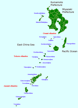
Amami Ōshima (奄美大島, Okinawan: Uushima (ウーシマ); Amami: Ushima (ウシマ)) is one of the Satsunan Islands, and is the largest island within the Amami archipelago between Kyūshū and Okinawa.[1]
The island, 712.35 km2 in area, has a population of approximately 73,000 people. Administratively it is divided into the city of Amami, the towns of Tatsugō, Setouchi, and the villages of Uken and Yamato in Kagoshima Prefecture. Much of the island is within the borders of the Amami Guntō Quasi-National Park.
Contents
1 Geography
2 Fauna
3 History
4 Economy
5 Transportation
6 Language
7 Notable people from Amami Ōshima
8 See also
9 References
10 External links
Geography
Amami Ōshima is the seventh-largest island in the Japanese archipelago (excluding the disputed Kuril Islands) after the four main islands, Okinawa Island and Sado Island. It is located approximately 380 kilometres (210 nmi) south of the southern tip of Kyūshū and 250 kilometres (130 nmi) north of Okinawa. The island is of volcanic origin, with Mount Yuwanda at 605 metres (1,985 ft) above sea level at its highest peak. The coast of the island is surrounded by a coral reef. It is surrounded by the East China Sea on the west and the Pacific Ocean on the east.
The climate of Amami Ōshima is classified as has a humid subtropical climate (Köppen climate classification Cfa) with very warm summers and mild winters. The rainy season lasts from May through September. The island is subject to frequent typhoons.
Fauna
Amami Ōshima is home to several rare or endangered endemic animals, including the Amami rabbit and the Lidth's jay, both of which are now found only in Amami Ōshima and Tokunoshima. The Amami rabbit is sometimes called a living fossil because it represents an ancient Asian lineage that has elsewhere disappeared.
The island is also home to the habu, a venomous snake that can be found throughout the Ryūkyū Islands. Mongooses were introduced to kill the habu, but have become another problem, as an increase in the mongoose population has been linked to the decline of the Amami rabbit and other endemic species.[2]
Whale watching to see humpback whales has become a featured attraction in winter in recent years.[3] It is also notable that North Pacific right whale, the most endangered of all whale species, have repeatedly appeared around the island[4] (there are five records of three sightings, a capture, and a stranding since 1901) and as of 2014[update], Amami is the only location in East China Sea where this species has been confirmed in the past 110 years. It is also one of two locations in the world along with the Bonin Islands where constant appearance in winter has been confirmed since the 20th century. Discovery of Indo-Pacific bottlenose dolphins in Seto strait made it the first confirmation in the nation. Other species include whales (Bryde's, sperm), smaller whales or dolphins (false killer, spinner, spotted), and so on. Before being wiped out, many large whales such as blue and fin were seasonal migrants.[5]
The island marks the northernmost limit of dugong distribution, with occasional sightings throughout the 20th and into the 21st century.[6]
Amami Oshima is the only place where a nesting of leatherback turtle has been seen in Japan.
History
It is uncertain when Amami Ōshima was first settled. Stone tools indicate settlement in the Japanese Paleolithic period, and other artifacts, including pottery, indicate a constant contact with Jōmon, Yayoi and Kofun period Japan.
The island is mentioned in the ancient Japanese chronicle Nihon Shoki in an entry for the year 657 AD. During the Nara period and early Heian period it was a stopping place for envoys from Japan to the court of Tang dynasty China. Mother of pearl was an important export item to Japan. Until 1611, Amami Ōshima was part of the Ryukyu Kingdom. The island was invaded by samurai from Shimazu clan in 1609 and its incorporation into the official holdings of that domain was recognized by the Tokugawa shogunate in 1624. Shimazu rule was harsh, with the inhabitants of the island reduced to serfdom and forced to raise sugar cane to meet high taxation, which often resulted in famine. Saigō Takamori was exiled to Amami Ōshima in 1859, staying for two years, and his house has been preserved as a memorial museum. After the Meiji Restoration Amami Ōshima was incorporated into Ōsumi Province and later became part of Kagoshima Prefecture. Following World War II, along with the other Amami Islands, it was occupied by the United States until 1953, at which time it reverted to the control of Japan.
Since February 1974, a 7,861-hectare (19,420-acre) area that includes portions of the island and surrounding sea has been protected as Amami Gunto Quasi-national Park.[7] The area also has a large mangrove forest.
IN 2001 there was a naval battle between a North Korean trawler and Japanese Coast Guard ships near the island, in which the North Korean ship was sunk.
Economy
The economy of Amami Ōshima is based on agriculture (sugar cane, rice and sweet potatoes), commercial fishing, and the distillation of shōchū. The favorable climate allows for two rice crops a year. Seasonal tourism is also an important part of the economy. The traditional crafts include the production of high quality hand-crafted silk, which has, however, suffered from the abandonment of traditional Japanese clothing and competition from overseas.
Transportation
The port of Naze, located in the city of Amami is a major regional shipping and ferry hub.
Amami Airport, located at the northern end of the island, is connected to Tokyo, Osaka, Naha, Fukuoka and Kagoshima as well as local flights to the other Amami islands.
Language
Two dialects of the Amami language are spoken in Amami Ōshima: the Northern Ōshima dialect and the Southern Ōshima dialect. These dialects are part of the Ryukyuan languages group. According to Ethnologue, as of 2005[update] there were about 10,000 speakers of the Northern Ōshima[8] dialect and about 1,800 speakers of the Southern Ōshima dialect.[9] These dialects are now spoken mostly by older residents of the island, while most of the younger generations are monolingual in Japanese. The Amami language, including the Ōshima dialects, is classified as endangered by UNESCO.
There is also a village sign language, named as Amami Oshima Sign Language, being used in the area.
Notable people from Amami Ōshima
Kenji Midori – karateka
Ikue Asazaki – singer
Chitose Hajime – singer
Kousuke Atari – singer
Minami Kizuki – singer
Rikki – singer
Rena Takeshita – fashion model
Domingos Chohachi Nakamura – Catholic missionary, who was born in Nagasaki and lived 26 years in Amami Oshima
See also
- Battle of Amami-Ōshima
References
^ Teikoku's Complete Atlas of Japan, Teikoku-Shoin Co., Ltd., Tokyo, .mw-parser-output cite.citation{font-style:inherit}.mw-parser-output q{quotes:"""""""'""'"}.mw-parser-output code.cs1-code{color:inherit;background:inherit;border:inherit;padding:inherit}.mw-parser-output .cs1-lock-free a{background:url("//upload.wikimedia.org/wikipedia/commons/thumb/6/65/Lock-green.svg/9px-Lock-green.svg.png")no-repeat;background-position:right .1em center}.mw-parser-output .cs1-lock-limited a,.mw-parser-output .cs1-lock-registration a{background:url("//upload.wikimedia.org/wikipedia/commons/thumb/d/d6/Lock-gray-alt-2.svg/9px-Lock-gray-alt-2.svg.png")no-repeat;background-position:right .1em center}.mw-parser-output .cs1-lock-subscription a{background:url("//upload.wikimedia.org/wikipedia/commons/thumb/a/aa/Lock-red-alt-2.svg/9px-Lock-red-alt-2.svg.png")no-repeat;background-position:right .1em center}.mw-parser-output .cs1-subscription,.mw-parser-output .cs1-registration{color:#555}.mw-parser-output .cs1-subscription span,.mw-parser-output .cs1-registration span{border-bottom:1px dotted;cursor:help}.mw-parser-output .cs1-hidden-error{display:none;font-size:100%}.mw-parser-output .cs1-visible-error{font-size:100%}.mw-parser-output .cs1-subscription,.mw-parser-output .cs1-registration,.mw-parser-output .cs1-format{font-size:95%}.mw-parser-output .cs1-kern-left,.mw-parser-output .cs1-kern-wl-left{padding-left:0.2em}.mw-parser-output .cs1-kern-right,.mw-parser-output .cs1-kern-wl-right{padding-right:0.2em}
ISBN 4-8071-0004-1
^ Watari Y, Yamada F, Sugimura K, Takatsuki S (2006). "Direct and indirect effects of an alien mongoose (Herpestes javanicus) on the native animal community on Amami-Oshima Island, southern Japan, as inferred from distribution patterns of animals" (PDF). Archived from the original (PDF) on 2011-07-22. Retrieved 2009-05-22.
^ Oki K., 2014. Amami whale and dolphin association. retrieved on 28-05-2014
^ Ito, H. (1 February 2014). "Endangered whale captured on film off Amami-Oshima". Asahi Shimbun. Archived from the original on 2 February 2014. Retrieved 2014-05-28.
^ Miyazaki N, Nakayama K (1989). "Records of Cetaceans in the Waters of the Amami Island". Memoirs of the National Science Museum (in Japanese). National Museum of Nature and Science, Museum of History and Folklore in Kasari. pp. 235–249. Retrieved 2015-01-12 – via CiNii.
^ Shirakihara M, Yoshida H, Yokochi H, Ogawa H, Hosokawa T, Higashi N, Kasuya T (1 July 2007). "Current status and conservation needs of dugongs in southern Japan" (PDF). Marine Mammal Science. 23 (3): 694–706. doi:10.1111/j.1748-7692.2007.00123.x.
^ "List of National and Quasi-national Parks". Ministry of the Environment, Government of Japan. Retrieved 2016-02-01.
^ Lewis MP; Simons GF; Fennig CD, eds. (2015). "Amami-Oshima, Northern". Ethnologue: Languages of the World (18th ed.). Retrieved 2016-02-01.
^ Lewis MP; Simons GF; Fennig CD, eds. (2015). "Amami-Oshima, Southern". Ethnologue: Languages of the World (18th ed.). Retrieved 2016-02-01.
- Eldridge, Mark. The Return of the Amami Islands: The Reversion Movement and U.S.–Japan Relations. Levington Books (2004)
ISBN 0739107100
- Hellyer. Robert. Defining Engagement: Japan and Global Contexts, 1640–1868. Harvard University Press (2009)
ISBN 0674035771
- Turnbull, Stephen. The Most Daring Raid of the Samurai. Rosen Publishing Group (2011)
ISBN 978-1448818723
- Ravina, Mark. The Last Samurai: The Life and Battles of Saigo Takamori. Whiley (2011)
ISBN 1118045564
- Yeo, Andrew. Activists, Alliances, and Anti-U.S. Base Protests. Cambridge University Press. (2011)
ISBN 1107002478
External links
| Wikivoyage has a travel guide for Amami Oshima. |
| Wikimedia Commons has media related to Amami Oshima. |
- Visitors Guide
 Geographic data related to Amami Ōshima at OpenStreetMap
Authority control |
|
|---|


