Attenborough, Nottinghamshire
| Attenborough | |
|---|---|
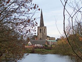 Attenborough Parish Church | |
 Attenborough Attenborough shown within Nottinghamshire | |
| Population | 2,328 (Ward. 2011) |
| OS grid reference | SK 51800 34548 |
| District |
|
| Shire county |
|
| Region |
|
| Country | England |
| Sovereign state | United Kingdom |
| Post town | NOTTINGHAM |
| Postcode district | NG9 |
| Dialling code | 0115 |
| Police | Nottinghamshire |
| Fire | Nottinghamshire |
| Ambulance | East Midlands |
| EU Parliament | East Midlands |
| UK Parliament |
|
Attenborough is a village and a suburb in the Broxtowe borough of Nottinghamshire. It forms part of Greater Nottingham, and is to the southwest of the city of Nottingham, between Long Eaton (to the southwest) and Beeston (to the northeast). The population of the ward within the Borough of Broxtowe taken at the 2011 Census was 2,328.[1] It adjoins the suburbs of Toton to the west and Chilwell to the north.
The village is the location of Attenborough railway station and of Attenborough Nature Reserve.[2]
Contents
1 Features
2 Flood defences
3 Local government and politics
4 History
5 Transport
5.1 Bus
5.2 Rail
5.2.1 Attenborough
5.2.2 Beeston
6 Notable Residents
7 References
Features
Attenborough Nature Reserve is a series of gravel pits, which were flooded after gravel extraction and are now a haven for birds and other wildlife.
The main commercial centre of Attenborough is around the junction of Nottingham Road (the A6005) and Attenborough Lane.
Nearer to the nature reserve is a tennis club, along with a private day-nursery,[3] which, in 2005, along with the Attenborough Prep School, was bought by Robert Everist, who then sold the nursery and closed the 100-year-old school. In media coverage it was claimed that Everist's company had pressured employees into handing in their notice a week before closing the company.[4] The Attenborough Cricket Club (which doubles as the village green) and St. Mary's Church (a Church of England parish church).[5] This southeastern part of Attenborough is bounded to the northwest by the railway line and on the other three sides by the wetlands of the nature reserve. It is the historic part of the village, with two listed buildings and the listed church itself.[6]
Some time ago[when?], a hoard of Roman coins was found on the footpath that runs over the railway and onto Barrett Lane.
Flood defences
The village was flooded in November 2000. In 2006, plans were drawn up for substantial flood defences for the village. However, the scheme proved controversial because of the impact of a proposed high flood wall along The Strand. After a series of negotiations, planning permission was granted in August 2010, with the defences being moved to behind the village green. The work was completed in summer 2012.[7]

Attenborough Nature Centre
Local government and politics
Attenborough is an unparished area and has no parish council. For local government and electoral purposes, Attenborough is one of the wards within Broxtowe and returns one councillor to the borough council. In the 2007 local elections the Conservatives won the seat.[8] For elections to Nottinghamshire County Council the village is covered by the electoral division of Beeston South & Attenborough (consisting of the Beeston Central, Beeston Rylands and Attenborough wards). In 2009, the Conservative candidate won the division.[9]
For elections to Parliament, the village is part of the Broxtowe constituency for which the present Member for Parliament is Anna Soubry (Conservative). She won the seat from the Labour Party at the 2010 general election.[citation needed]
History
Attenborough was known in Saxon times as Addensburgh. It was the home village of Henry Ireton (1611 – 26 November 1651), an English general in the army of Parliament during the English Civil War and son-in-law of Oliver Cromwell.[10]
During the First World War, the railway station had its platforms extended as it was used as an interchange for soldiers heading for Chetwynd Barracks. During the Second World War, the platforms were said to be the longest in Europe due to their proximity to the base.[citation needed]
In the graveyard of St Mary's Church there is a memorial to the 134 people killed on 1 July 1918 in an explosion in the shell factory in nearby Chilwell. This death toll remains the largest number of deaths caused by a single explosion in mainland Britain.[11][12]
A ferry (Barton Ferry) used to cross the River Trent from the mouth of the River Erewash (near Attenborough) to Barton in Fabis. A crossing existed at this point since before 1774.[13]
Transport
Road transport is the primary method of transport in and out of the area which is connected to Nottingham by the A6005. East Midlands Airport is approximately 16 kilometres away; the airport serves domestic and international routes, focused mainly on EU, EEA and Swiss routes.
Bus
Bus services operate to Nottingham, Derby, Beeston, Stapleford, Long Eaton and other local towns.
- Trent Barton
- Indigo: Nottingham – QMC – University Boulevard – Beeston – Chilwell – Attenborough – Toton – Long Eaton / Derby / Sawley / Loughborough (Via East Midlands Airport).
Rail
Attenborough
An hourly service is provided throughout the day by East Midlands Trains Matlock to Nottingham service. Additional services run at peak times, including some operated by CrossCountry.
Beeston
Beeston railway station is approximately 3 km away. It provides regular and direct connections to various locations across the United Kingdom.
Notable Residents
Henry Ireton Roundhead General during the English Civil War, and son-in-law to Oliver Cromwell, born in Attenborough in 1611.
Sophia Di Martino actress in tv series including Flowers, Friday Night Dinner and Casualty, born in Attenborough in 1983.[14]
References
| Wikimedia Commons has media related to Attenborough, Nottinghamshire. |
^ "Broxtowe ward population 2011". Neighbourhood Statistics. Office for National Statistics. Retrieved 3 April 2016..mw-parser-output cite.citation{font-style:inherit}.mw-parser-output .citation q{quotes:"""""""'""'"}.mw-parser-output .citation .cs1-lock-free a{background:url("//upload.wikimedia.org/wikipedia/commons/thumb/6/65/Lock-green.svg/9px-Lock-green.svg.png")no-repeat;background-position:right .1em center}.mw-parser-output .citation .cs1-lock-limited a,.mw-parser-output .citation .cs1-lock-registration a{background:url("//upload.wikimedia.org/wikipedia/commons/thumb/d/d6/Lock-gray-alt-2.svg/9px-Lock-gray-alt-2.svg.png")no-repeat;background-position:right .1em center}.mw-parser-output .citation .cs1-lock-subscription a{background:url("//upload.wikimedia.org/wikipedia/commons/thumb/a/aa/Lock-red-alt-2.svg/9px-Lock-red-alt-2.svg.png")no-repeat;background-position:right .1em center}.mw-parser-output .cs1-subscription,.mw-parser-output .cs1-registration{color:#555}.mw-parser-output .cs1-subscription span,.mw-parser-output .cs1-registration span{border-bottom:1px dotted;cursor:help}.mw-parser-output .cs1-ws-icon a{background:url("//upload.wikimedia.org/wikipedia/commons/thumb/4/4c/Wikisource-logo.svg/12px-Wikisource-logo.svg.png")no-repeat;background-position:right .1em center}.mw-parser-output code.cs1-code{color:inherit;background:inherit;border:inherit;padding:inherit}.mw-parser-output .cs1-hidden-error{display:none;font-size:100%}.mw-parser-output .cs1-visible-error{font-size:100%}.mw-parser-output .cs1-maint{display:none;color:#33aa33;margin-left:0.3em}.mw-parser-output .cs1-subscription,.mw-parser-output .cs1-registration,.mw-parser-output .cs1-format{font-size:95%}.mw-parser-output .cs1-kern-left,.mw-parser-output .cs1-kern-wl-left{padding-left:0.2em}.mw-parser-output .cs1-kern-right,.mw-parser-output .cs1-kern-wl-right{padding-right:0.2em}
^ "Attenborough Nature Centre & Reserve".
^ "Attenborough Day Nursery".
^ "Directory". Directory Blog. Retrieved 17 February 2009.
^ "Attenborough - History".
^ Beeston and District Civic Society Archived 12 August 2011 at the Wayback Machine Listed buildings
^ Britton, Alexander (November 28, 2012). "£45m flood defences used for first time to safeguard 175 homes across Notts". Nottingham Post. Local World. Retrieved April 8, 2017.
^ Broxtowe Borough Council Election results 2007–10 by ward
^ Nottinghamshire County Council Beeston South & Attenborough election result 2009
^ "Nottinghamshire history > Links with old Nottingham (1928): Attenborough: Ireton's House".
^ Maureen Rushton, Local Historian in her book "The canary girls of Chilwell: the story of No. 6 Shell Filling Factory, Chilwell, Nottinghamshire"
^ Woollacott, Angela (1994). On Her Their Lives Depend: Munitions Workers in the Great War. Oakland: University of California Press. p. 84. ISBN 978-0520085022.
^ Chapman, John (1774). Map of Nottinghamshire. ISBN 0-902751-46-8.
^ BBC Nottingham People - Sophia di Martino
Nottinghamshire Portal | |
| Unitary authorities | Nottingham |
| Boroughs or districts |
|
| Major settlements |
|
| Topics |
|


