Ebbesbourne Wake
| Ebbesbourne Wake | |
|---|---|
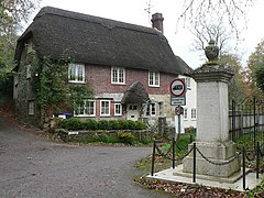 War memorial and Old Forge Cottage, Ebbesbourne Wake | |
 Ebbesbourne Wake Location within Wiltshire | |
| Population | 222 (in 2011)[1] |
| OS grid reference | ST992242 |
| Civil parish |
|
| Unitary authority |
|
| Ceremonial county |
|
| Region |
|
| Country | England |
| Sovereign state | United Kingdom |
| Post town | Salisbury |
| Postcode district | SP5 |
| Dialling code | 01722 |
| Police | Wiltshire |
| Fire | Dorset and Wiltshire |
| Ambulance | South Western |
| EU Parliament | South West England |
| UK Parliament |
|
Ebbesbourne Wake is a village and civil parish in Wiltshire, England, approximately 10 miles (16 km) south-west of Salisbury. The parish lies near the head of the valley of the small River Ebble, and includes the hamlets of Fifield Bavant and West End.
Contents
1 History
2 Parish church
3 Chapel
4 Local government
5 Amenities
6 References
7 External links
History
It is not known when Ebbesbourne was first inhabited or what it was called but fragmentary records from Saxon times (circa 826 AD) indicate that the whole Chalke Valley area was thriving, and the village was called Eblesburna. It is surmised that the land adjacent to the bourne (river) was once owned by a man called Ebbel.[2] Note that the word bourne is derived from the Old English "brunna".[3]
Mention is made of Ebbesbourne in the extant will of a Dorset woman, Wynflæd, in Latin. It is the earliest woman's will ("a small, stained sheet of parchment") to survive in British history. In a detailed testament, she bequeaths to her daughter Æthelflœd an engraved bracelet, a brooch, several named household articles, including books, and "the farm at Ebbesbourne with the title deed as a perpetual inheritance... and the men and the livestock on the land there to her too." The will was placed on display at the British Library in late 2018 and early 2019.[4]
The Domesday Book of 1086 divided the Chalke Valley into eight manors: Chelke (Chalke - Bowerchalke and Broadchalke), Eblesborne (Ebbesbourne Wake), Fifehide (Fifield), Cumbe (Coombe Bissett), Humitone (Homington), Odestoche (Odstock), Stradford (Stratford Tony and Bishopstone) and Trow (circa Alvediston and Tollard Royal).[5]
Peter Meers, in his book Ebbesbourne Wake through the Ages, translates the village's Domesday entry as:
Robert holds Eblesborne from Robert. Aluard and Fitheus held it before 1066 as two manors. (TRE = tempore Regis Edwardii, the time of Edward the Confessor, 1042-1066) Taxed for 14 hides.
Land for ten ploughs. In lordship ten hides, there six ploughs.
Four slaves (serfs). Eighteen villeins (villagers). Seven [Serfdom#Bordars|bordars (smallholders)]] with four ploughs.
Fourteen acres of meadow, pasture fourteen furlongs long, 4 furlongs wide.
Woodlands two leagues length and width. Value £12, now £14.[2]
Geoffrey de Wak became Lord of the manor in 1204; although his relationship to Hereward the Wake is unknown, the shield of Hereward's coat of arms can today be seen on the church tower. By 1249 the settlement was known as Ebbelburn Wak. By 1785 it was known as Ebesborne Wake.[6]
In the 12th century the area was known primarily as the Stowford Hundred, then subsequently as the Chalke Hundred. This included the parishes of Berwick St John, Ebbesbourne Wake, Fifield Bavant, Semley, Tollard Royal and 'Chalke'.[6]
Although the name Ebbesbourne Wake has developed over time, the spelling has never been completely settled. The Ordnance Survey of 1889 and 1927 used Ebbesborne Wake, whilst the 1963 and 1974 maps used the 'orne' spelling for the parish, but named the village Ebbesbourne Wake. Historian Peter Meers notes in his book Ebbesbourne Wake through the Ages that Fowler's A Dictionary of Modern English Usage of both 1926 and 1965 describes the spelling of 'bourne/borne' as inconsistent.[7]
Manor Farmhouse is from the 17th century, with rebuilding and additions in the 18th and 19th.[8] A National School was opened in or before 1846; a schoolroom was built in 1854 and a teacher's house in 1870. The school closed in 1985 owing to low numbers of pupils.[9]
When the civil parish of Fifield Bavant was extinguished in 1894, its land was transferred to Ebbesbourne Wake parish.[9]
Parish church

St John's Church
There has been a church at Ebbesbourne Wake since the 13th century.[9] The present church is largely 14th century, with 13th-century window details and a 12-century font.[10]
The tower has five bells, of which four are from the 17th century.[11] The church was designated as Grade II* listed in 1960.[10]
From 1859 the vicar of Ebbesbourne was also rector of Fifield Bavant, but it was not until 1923 that the two ecclesiastical parishes were united.[12] In 1970 the benefice was united with Alvediston[13] and today the church is part of the Chalke Valley group of churches.[14]
Chapel
An independent meeting house was established in 1782 at a cottage called Buntings.[15][16] Circa 1791 the congregation moved to a former coach house, belonging to the Earl of Pembroke, not far from the church; in 1857 a new stone chapel was built on the same site.[17]
Local government
The civil parish has an elected parish council. The parish is in the area of Wiltshire Council unitary authority, which is responsible for all significant local government functions.
Amenities
There is a village hall and a pub, the Horseshoe Inn.
References
Meers, Peter (2006). Ebbesbourne Wake through the Ages (PDF). Dial Cottage Press. Retrieved 19 August 2016..mw-parser-output cite.citation{font-style:inherit}.mw-parser-output .citation q{quotes:"""""""'""'"}.mw-parser-output .citation .cs1-lock-free a{background:url("//upload.wikimedia.org/wikipedia/commons/thumb/6/65/Lock-green.svg/9px-Lock-green.svg.png")no-repeat;background-position:right .1em center}.mw-parser-output .citation .cs1-lock-limited a,.mw-parser-output .citation .cs1-lock-registration a{background:url("//upload.wikimedia.org/wikipedia/commons/thumb/d/d6/Lock-gray-alt-2.svg/9px-Lock-gray-alt-2.svg.png")no-repeat;background-position:right .1em center}.mw-parser-output .citation .cs1-lock-subscription a{background:url("//upload.wikimedia.org/wikipedia/commons/thumb/a/aa/Lock-red-alt-2.svg/9px-Lock-red-alt-2.svg.png")no-repeat;background-position:right .1em center}.mw-parser-output .cs1-subscription,.mw-parser-output .cs1-registration{color:#555}.mw-parser-output .cs1-subscription span,.mw-parser-output .cs1-registration span{border-bottom:1px dotted;cursor:help}.mw-parser-output .cs1-ws-icon a{background:url("//upload.wikimedia.org/wikipedia/commons/thumb/4/4c/Wikisource-logo.svg/12px-Wikisource-logo.svg.png")no-repeat;background-position:right .1em center}.mw-parser-output code.cs1-code{color:inherit;background:inherit;border:inherit;padding:inherit}.mw-parser-output .cs1-hidden-error{display:none;font-size:100%}.mw-parser-output .cs1-visible-error{font-size:100%}.mw-parser-output .cs1-maint{display:none;color:#33aa33;margin-left:0.3em}.mw-parser-output .cs1-subscription,.mw-parser-output .cs1-registration,.mw-parser-output .cs1-format{font-size:95%}.mw-parser-output .cs1-kern-left,.mw-parser-output .cs1-kern-wl-left{padding-left:0.2em}.mw-parser-output .cs1-kern-right,.mw-parser-output .cs1-kern-wl-right{padding-right:0.2em}
^ "Wiltshire Community History - Census". Wiltshire Council. Retrieved 21 January 2015.
^ ab Meers 2006, p. 3.
^ http://www.etymonline.com/index.php?term=bourn
^ Michael Wood: "Wynflæd's Will". History Today, November 2018, pp. 78–83.
^ Meers 2006, p. 5.
^ ab Meers 2006, pp. 3-4.
^ Meers 2006, p. 4.
^ Historic England. "Manor Farmhouse (1250082)". National Heritage List for England. Retrieved 19 August 2016.
^ abc Freeman, Jane; Stevenson, Janet H (1987). Crowley, D.A., ed. "Victoria County History: Wiltshire: Vol 13 pp52-60 - Ebbesborne Wake". British History Online. University of London. Retrieved 19 August 2016.
^ ab Historic England. "Church of St John the Baptist (1318690)". National Heritage List for England. Retrieved 18 August 2016.
^ "Ebbesbourne Wake, St John". Dove's Guide for Church Bell Ringers. Retrieved 18 August 2016.
^ "No. 32870". The London Gazette. 12 October 1923. pp. 6837–6839.
^ "No. 45057". The London Gazette. 10 March 1970. p. 2856.
^ "Ebbesbourne Wake - St John the Baptist". Chalke Valley Church. Retrieved 18 August 2016.
^ Meers 2006, p. 149.
^ Historic England. "Buntings (1318691)". National Heritage List for England. Retrieved 18 August 2016.
^ Meers 2006, p. 151.
External links
![]() Media related to Ebbesbourne Wake at Wikimedia Commons
Media related to Ebbesbourne Wake at Wikimedia Commons
"Ebbesbourne Wake". Wiltshire Community History. Wiltshire Council. Retrieved 16 October 2015.


