Peene
| Peene | |
|---|---|
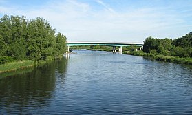 Peene river near Jarmen | |
 Peene river, its affluents, and Peenestrom strait | |
| Location | |
| Country | Germany |
| State | Mecklenburg-Vorpommern |
| Cities | Demmin, Anklam |
| Physical characteristics | |
| Source | Westpeene |
| - location | Vollrathsruhe |
| - elevation | 30 m (98 ft) |
| 2nd source | Ostpeene |
| - location | Schloen |
| - elevation | 80 m (260 ft) |
| 3rd source | Kleine Peene (Teterower Peene) |
| - location | Groß Wokern |
| - elevation | 85 m (279 ft) |
| Mouth | Peenestrom |
- location | Anklam |
- coordinates | 53°51′46″N 13°48′52″E / 53.86278°N 13.81444°E / 53.86278; 13.81444Coordinates: 53°51′46″N 13°48′52″E / 53.86278°N 13.81444°E / 53.86278; 13.81444 |
- elevation | 0 m (0 ft) |
| Length | 138.5 km (86.1 mi) |
| Basin size | 5,110 km2 (1,970 sq mi) |
| Discharge | |
| - average | 20.6 m3/s (730 cu ft/s) |
| Basin features | |
| Tributaries | |
| - left | Trebel |
| - right | Tollense |
The Peene (German: [ˈpeːnə] (![]() listen)) is a river in Germany. The Westpeene, with Ostpeene as its longer tributary, and Kleine Peene/Teterower Peene (with a Peene without specification as its smaller and shorter affluent) flow into Kummerower See (Lake Kummerow), and from there as Peene proper to Anklam and into the Oder Lagoon.
listen)) is a river in Germany. The Westpeene, with Ostpeene as its longer tributary, and Kleine Peene/Teterower Peene (with a Peene without specification as its smaller and shorter affluent) flow into Kummerower See (Lake Kummerow), and from there as Peene proper to Anklam and into the Oder Lagoon.
From Kummerower See, inclusively, to the mouth, the ground of the water is five feet and more below sea level. This makes water level and flows liable to the water level of Baltic Sea and Oder, including reverse flows.
The Peene Valley is one of the largest contiguous fen regions in central Europe.[1] Thanks to its wilderness and intact nature, the river Peene and its valley is sometimes grandiloquently referred to as "the Amazon of the North".[2]
The western branch of the Oder River, which separates the island of Usedom from the German mainland, is often also called Peene, but actually is considered a part of the Baltic Sea called the Peenestrom. It is one of three channels connecting the Oder Lagoon with the Bay of Pomerania of the Baltic Sea. (The other channels are the Świna and the Dziwna.)
Major towns at the Peene river are Malchin, Teterow, Demmin and Anklam.
Wolgast is on Peenestrom strait.
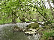
Ostpeene

Old watermill on Kleine Peene in Teterow

Peene harbour in Demmin
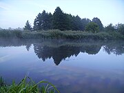
Peene river near Loitz
Peene river near Jarmen

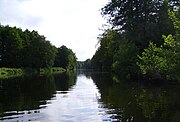
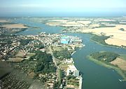
Peene river in Anklam
Peenestrom strait with Wolgast
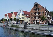
Peenestrom harbour in Wolgast


References
^ Peenetal / Peene-Haff-Moor Archived 2012-01-14 at the Wayback Machine at www.bfn.de.
^ Peene: Paddeln auf dem Amazonas des Nordens (Spiegel Online)
External links
 Media related to Peene at Wikimedia Commons
www.peenetal-landschaft.de - Association for natural protection of the Peene river valley (German)
Authority control |
|
|---|
This article related to a river in Mecklenburg-Vorpommern is a stub. You can help Wikipedia by expanding it. |


