卡斯特羅谷
body.skin-minerva .mw-parser-output table.infobox caption{text-align:center}
| 卡斯特羅谷 | |
|---|---|
CDP | |
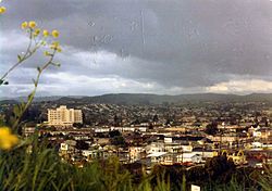 Castro Valley, ca. 1970 | |
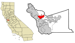 在阿拉米達郡的位置 | |
 卡斯特羅谷 在美國的位置 | |
坐标:37°43′N 122°04′W / 37.71°N 122.06°W / 37.71; -122.06[1] | |
| 國家 | |
| 州 | |
| 郡 | 阿拉米達郡 |
| 政府 | |
| • 州參議院 | Bob Wieckowski (D)[2] |
| • 州眾議員 | Bill Quirk (D)[3] |
| • 美國國會 | Eric Swalwell (D)[4] |
| 面积[5] | |
| • 总计 | 16.919 平方英里(43.819 平方公里) |
| • 陸地 | 16.635 平方英里(43.083 平方公里) |
| • 水域 | 0.284 平方英里(0.735 平方公里) 1.68% |
| 海拔[6] | 161 英尺(49 米) |
| 人口(2010) | |
| • 總計 | 61,388 |
| • 密度 | 3,690.3/平方英里(1,424.8/平方公里) |
| 时区 | PST (UTC-8) |
| • 夏时制 | PDT(UTC-7) |
ZIP codes | 94546, 94552 |
| 電話區號 | 510 |
| FIPS code | 06-11964 |
GNIS feature IDs | 1658237, 2407987 |
卡斯特羅谷(Castro Valley)是美國的一個普查規定居民點,位於加利福尼亞州阿拉米達郡。據2000年人口普查,卡斯特羅谷是加利福尼亞州人口第五多的非建制地區,也是美國人口第23多的非建制地區。
參考資料
^ US Gazetteer files: 2010, 2000, and 1990. United States Census Bureau. 12 February 2011 [23 April 2011].
^ Senators. State of California. [18 March 2013].
^ Members Assembly. State of California. [18 March 2013].
^ 該州第 15屆國會選區-代表和選區地圖. Civic Impulse, LLC. [14 March 2013].
^ U.S. Census. [15 September 2012].
^ Castro Valley. 美国地质局地理名称信息系统.
外部連結
维基共享资源中相关的多媒体资源:卡斯特羅谷 |
Castro Valley. 美国地质局地理名称信息系统.
- Castro Valley Chamber of Commerce
- Castro Valley News - Local News and Information
- Castro Valley Matters - Local Advocacy Group
- Castro Valley history
- Castro Valley Unified School District
- Friends of San Lorenzo Creek