Peru–Chile Trench
Peru–Chile Trench
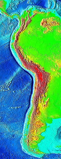
The Peru–Chile Trench, also known as the Atacama Trench, is an oceanic trench in the eastern Pacific Ocean, about 160 kilometres (100 mi) off the coast of Peru and Chile.[1] It reaches a maximum depth of 8,065 meters (26,460 ft) below sea level in Richards Deep (23°10′45″S 71°18′41″W / 23.17917°S 71.31139°W / -23.17917; -71.31139) and is approximately 5,900 kilometres (3,666 mi) long; its mean width is 64 kilometres (40 mi) and it covers an expanse of some 590,000 square kilometres (228,000 mi²).
The trench delineates the boundary between the subducting Nazca Plate and the overriding South American Plate.
Contents
1 Geology
2 Oceanography
3 Biology
4 Associated seismicity
5 See also
6 References
Geology
The trench is a result of a convergent boundary, where the eastern edge of the oceanic Nazca Plate is being subducted beneath the continental South American Plate.[1] Two seamount ridges within the Nazca Plate enter the subduction zone along this trench: the Nazca Ridge and the Juan Fernández Ridge.
From the Chile Triple Junction to Juan Fernández Ridge the trench is filled with 2.0–2.5 km of sediments, creating a flat bottom topography. Sediments are mainly turbidites interspersed with oceanic deposits of clay, volcanic ash, and siliceous ooze.[1]
The Peru–Chile Trench, the forearc and the western edge of the central Andean plateau (Altiplano), delineate the dramatic "Bolivian Orocline" that defines the Andean slope of southern Peru, northern Chile, and Bolivia.
Oceanography
Most of the time, the trade winds drive surface waters offshore near the equator, driving the Humboldt Current from the tip of southern Chile to northern Peru. This current is associated with upwelling of deep, nutrient-rich water off the coast of Peru.[2] At times, El Nino disrupts the usual wind pattern and lessens the upwelling. The consequent loss of nutrient causes fish kills.
Biology
In 2018, three new species were discovered thriving in the inhospitable depths of the Atacama Trench.[3][4]
Associated seismicity

Significant Earthquake Faults and damaging earthquakes over the past century along the South American Subduction Zone[5]

South America showing 100-year earthquake shaking projections.[5]
The subduction of the Nazca Plate below the South American Plate along the Chile-Peru Trench is associated with numerous earthquakes. Several of these earthquakes are notable for their size, associated tsunamis, and landslides.
- 1570 Concepcion earthquake: Mw ~8.3
1687 Peru earthquake: Mw ~8.7
1730 Valparaíso earthquake Ms ~8.7
1746 Lima–Callao earthquake: Mw ~8.7
1868 Arica earthquake: Mw ~9.0- 1877 Offshore Tarapaca, Chile:[6]Mw ~8.3
- 1906 Valparaíso earthquake
1942 Peru earthquake: Mw 8.2 event associated with a tsunami, the rupture dimensions and epicenter are similar to those of a 1996 earthquake
1960 Valdivia earthquake: At Mw 9.5, the largest earthquake ever recorded on the earth
November 1960 Peru earthquake: This event had a long source duration, leading to a significant discrepancy between different moment calculation methods (Ms 6.75 vs Mw 7.8)
1970 Ancash earthquake: This Mw7.9 event triggered a landslide with large snow and ice components, killing ~68,000 people
2001 southern Peru earthquake: Mw 8.4- 2005 Tarapacá earthquake
- 2007 Tocopilla earthquake
2007 Peru earthquake: Mw 8.0
2010 Chile earthquake: Mw 8.8 event associated with a tsunami- 2010 Pichilemu earthquake
- 2014 Iquique earthquake
- 2015 Illapel earthquake
See also
- Oceanic trench
- Pacific Ring of Fire
References
^ abc "Peru-Chile Trench". Encyclopædia Britannica. Retrieved April 21, 2014..mw-parser-output cite.citation{font-style:inherit}.mw-parser-output .citation q{quotes:"""""""'""'"}.mw-parser-output .citation .cs1-lock-free a{background:url("//upload.wikimedia.org/wikipedia/commons/thumb/6/65/Lock-green.svg/9px-Lock-green.svg.png")no-repeat;background-position:right .1em center}.mw-parser-output .citation .cs1-lock-limited a,.mw-parser-output .citation .cs1-lock-registration a{background:url("//upload.wikimedia.org/wikipedia/commons/thumb/d/d6/Lock-gray-alt-2.svg/9px-Lock-gray-alt-2.svg.png")no-repeat;background-position:right .1em center}.mw-parser-output .citation .cs1-lock-subscription a{background:url("//upload.wikimedia.org/wikipedia/commons/thumb/a/aa/Lock-red-alt-2.svg/9px-Lock-red-alt-2.svg.png")no-repeat;background-position:right .1em center}.mw-parser-output .cs1-subscription,.mw-parser-output .cs1-registration{color:#555}.mw-parser-output .cs1-subscription span,.mw-parser-output .cs1-registration span{border-bottom:1px dotted;cursor:help}.mw-parser-output .cs1-ws-icon a{background:url("//upload.wikimedia.org/wikipedia/commons/thumb/4/4c/Wikisource-logo.svg/12px-Wikisource-logo.svg.png")no-repeat;background-position:right .1em center}.mw-parser-output code.cs1-code{color:inherit;background:inherit;border:inherit;padding:inherit}.mw-parser-output .cs1-hidden-error{display:none;font-size:100%}.mw-parser-output .cs1-visible-error{font-size:100%}.mw-parser-output .cs1-maint{display:none;color:#33aa33;margin-left:0.3em}.mw-parser-output .cs1-subscription,.mw-parser-output .cs1-registration,.mw-parser-output .cs1-format{font-size:95%}.mw-parser-output .cs1-kern-left,.mw-parser-output .cs1-kern-wl-left{padding-left:0.2em}.mw-parser-output .cs1-kern-right,.mw-parser-output .cs1-kern-wl-right{padding-right:0.2em}
^ "Peru-Chile Trench". Oceana. Archived from the original on August 25, 2014. Retrieved April 21, 2014.
^ Wang, Amy, Scientists discover three new sea creatures in depths of the Pacific Ocean, The Washington Post, Wednesday, September 12, 2018
^ "'Gel-like' see-through fish discovered 7.5km down on Pacific ocean floor". The Guardian. 2018-09-15.
^ ab USGS USGS Authors New Report on Seismic Hazard, Risk, and Design for South America
^ "Historic World Earthquakes: Chile". United States Geological Survey. Archived from the original on 2010-07-28.
Coordinates: 23°S 71°W / 23°S 71°W / -23; -71


